photo location finder

Main Features
- Hybrid Analysis Engine: Combines EXIF data extraction with powerful AI visual analysis, ensuring the highest chance of success to find a location from a picture.
- Transparent AI Process: A unique 'AI Reasoning' panel shows how the system identifies a location, building unparalleled trust and insight.
- Interactive Map Results: Don't just get coordinates. Explore the location on a dynamic map with zoom, satellite view, and more.
- Privacy First: Your uploads are confidential. Images are processed securely and never shared or stored without your consent.
- Analysis History: Keep track of all searches. Easily revisit past results from a personal and private analysis history dashboard.
- Blazing-Fast & Responsive: Built on modern technology, the photo location finder delivers results in seconds on any device, desktop or mobile.
How It Works
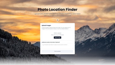
- Upload Your Image: Simply drag and drop a photo or click to select a file. The platform is secure and privacy-focused.
- Initiate AI Analysis: With one click, the photo location finder starts its work. It first checks for EXIF GPS data and then deploys AI to scan for visual clues.
- See the AI's Reasoning: The unique interface shows exactly how the AI is thinking—from identifying a landmark to analyzing architectural styles.
- Get Your Precise Location: View the pinpointed location on an interactive map, complete with coordinates. All past searches are saved in history for easy access.
Target Users
- Professional Investigators: Professionals who demand precision and reliability.
- Journalists: For verifying image sources to ensure the authenticity of news reports.
- Travel Bloggers: To retrace steps and add geotags to their portfolios.
- Curious Travelers: Users curious about where a photo was taken.
- Casual Users: People trying to identify the location of old family photos.
Core Advantages
- Superior Accuracy: The dual EXIF and AI engine provides more reliable results than simple metadata viewers or basic AI tools.
- Unmatched Transparency: Shows how the conclusion was reached, a feature not found in most other location-finder-by-picture services.
- Built for Professionals: While simple enough for anyone, the tool is powerful enough for journalists, investigators, and photographers.
- Intuitive User Experience: No complex software to install. The clean, web-based interface makes finding a photo's location fast and effortless.
- Commitment to Trust: From the transparent AI process to the strict privacy policy, every aspect is designed to earn and keep trust.
Frequently Asked Questions
- How to find the location of a photo?
- Can you find a location if the photo has no GPS data?
- How accurate is this picture location finder?
- Is my uploaded photo kept private and secure?
- What kind of photos work best with the photo location finder?
- Can I use this tool for professional work, like journalism or investigation?
- Is there a limit to how many photos I can check?
- What is EXIF data?
- Can this tool identify the location of old, scanned photos?
- How does this differ from a reverse image search?
가격 모델:
Free
의론